Launching from Front Royal (Route 340 and 66) 7/24/2004:
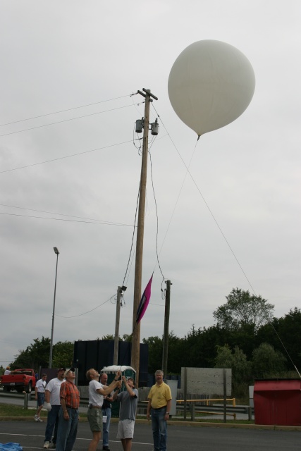
We successfully launched the balloon at 10:29 this morning. We had about 6.5 pounds of bouyancy. The ascent rate was almost exactly as planned at 1000 feet per minute. The balloon track did not follow any of the projected tracks however some features of some of the predictions did appear in the actual flight.
We reached 99,500 feet at 12:03 PM and moments later the balloon burst. Descent was very rapid at first and as expected. The descent rate did not slow as much as we expected with the balloon still dropping at 1700 to 1800 feet per minute when it was 10,000 feet up.
We were driving around during the entire flight and were close to the landing site when the payload came down. A few of us were able to spot the parachute and payload when it was at about 2000 feet, and just before touchdown.
Arriving near the landing site, we lucked into meeting the landowner whose son had actually seen the payload coming down under parachute. We were invited onto her land but her husband, who was not home, did not want us going out into the pasture where it landed because of their electric fences. Mike very quickly identified our parachute in the pasture by scanning with binoculars. After we knew where to look we could easily see the parachute with the unaided eye. We ended up spending about an hour and a half on the farm visiting with the people there before the landowner ended up walking out into the pasture about a half a mile to retrieve the payload and parachute.
The reason for the rapid descent became apparent when she brought it back -- the balloon had become entangled in the parachute shroud lines at burst, keeping the parachute from fully inflating.
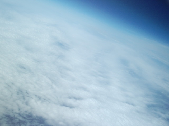
The camera in the payload contained several hundred photos -- many of them of cloud tops. There are a number of good shots in there. I'm sure we'll get them posted soon.
Even though it was an early start. The day was a great success. After meeting at Pete's then going to get more helium to make sure we had plenty for the balloon. We then drove out to Front Royal and met up with about 4 other carloads that were waiting on us to show up.
Ben got the payload running while the rest were getting the helium and tarp out to setup for the filling and launch. Then after making sure the payload was functioning we hooked it all up and sent it aloft in to the gray clouds that loomed overhead. We got some funny looks from people that were driving through the parking lot and saw what we were doing.
After the launch we waited to see which way it was going to head before moving out to follow and keep up with it. That in itself was a test just trying to follow the balloon the way it kept changing course and we were trying to find good roads to go on to keep it in close range. When we pulled over it was fun to watch the car driving by and the looks they were giving us as we all kept huddling around cars with computers and radios all over the place. At each stop the kids along for the fun seemed to always find "toys" to play with and keep themselves entertained while we all discussed the balloon and what it was doing and might do.
When we saw it was getting close to what had been planned for burst altitude we all got on the radio and were taking numbers at what altitude it would pop. Then came the hectic time of trying to predict where it was coming down at and to get in that area. We lucked up and went down "Dismal Hollow Road" and that was where Pete and I first saw it coming out of the clouds and dropping to the ground. We then turned the cars around and raced back to the area we thought it would land in. Lucked out and actually stopped in the driveway of the farm it landed on to discuss what and where it might be.
After the landowner invited us to come down on the property to wait till her husband got home to turn off the electric fences. The parachute and payload were spotted about ˝ mile away in the middle of a cow pasture. There did not seem to be any hurt cows or any unwanted residue on the payload so it came down in a good spot. Which was also only hundreds of feet from high voltage power lines. The owner finally retrieved it for us and we had Ben's lunch box back. Now he will not go hungry at school when he gets to MIT. I want to thank Ben Pete and All the rest for putting this on. It was a very good and fun day. I hope to be a part of many more to come.
Here is some of the information from the balloon tracking software we were using:
FlightPath040724.jpg: This is the map of the balloon track. It's hard to read because the balloon flew back over the launch site two times before landing. The launch site is just north of Front Royal at 66 and 340. The balloon headed south, then east over Linden and Markham. It then swung north and back west over the launch site then over George Washington National Forest where the balloon burst. It then continued west then swung north again then back east over the launch site again, then turned south before landing in a farmers field in Markham. Over the entire flight, the balloon travelled around 40 to 45 miles.