Balloon Flight VWS-2
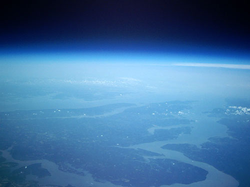 |
| View from 75,000 feet: The Potomac River meets the Chesapeake Bay with the Eastern Shore in the background. [large] [satellite] |
|
| View from 75,000 feet: The Potomac River meets the Chesapeake Bay with the Eastern Shore in the background. [large] [satellite] |
Flight Summary
VWS-2 was launched from Front Royal, VA at 10:03am on July 23, 2005. The balloon rose to an altitude in excess of 98,000 feet before bursting and returning to earth near Burr Hill, VA, 44.5 miles from the launch site, at 12:05pm.
Payload Summary
Flight Data/Telemetry
Telemetry from the balloon flight is currently available in an Excel spreadsheet which also contains several plots of the data. GIF versions of all of the plots will be made available online soon.
A text file containing all of the raw position data and telemetry downlinked on 144.34MHz is available here. This file is formatted to be playable in UI-View32 using the "Play Log" feature. Just drop it in the LOGS folder in your UI-View32 program directory.
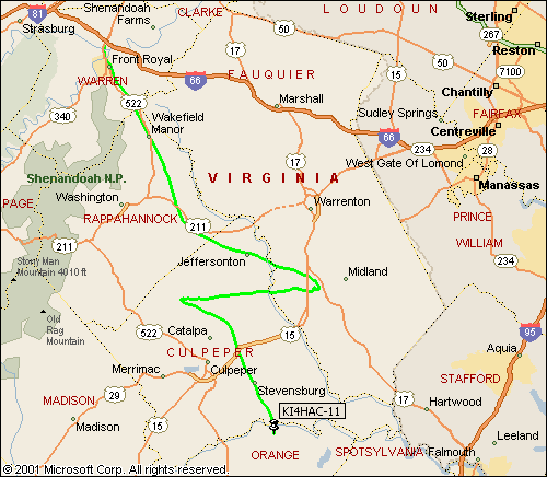
A complete Microsoft MapPoint file showing the complete track of the balloon is available here.
Photos
In-flight Photos
Ground Photos
![[large]](IMG_0085_pshop.jpg)
![[satellite]](googleearth_85.jpg)